Happening Now: NTV KENYA LIVE | Senate Proceedings
Premium
Exploring Kenya’s northwest by road
I reckon that the Kenya Rough Guide has a lot to interest Kenyans as well as foreign tourists.

‘What an awe-inspiring experience you enjoyed,’ my niece Helen wrote. ‘How wonderful and memorable.’ She had been reading my last two Going Places articles about the safari by helicopter to Lake Turkana and the Mathews Mountain Range. What she said is very true. And I realise that, for me, such a trip was only possible because I have a son who is a professional safari guide.
I also realise that, like me, most people reading those articles would not be able to afford, or would not wish to pay for such a ‘high-end’ safari. But, as I wrote last week, you don’t need a helicopter to explore those amazing places in the northwest. And I am now in a better position to advise about travelling in the northern counties of Turkana and Marsabit, which, unlike the mainly arid north-eastern counties of Wajir and Mandera, have a great variety of landscapes and peoples. As the Rough Guide says, ‘This vast region remains one of the most exciting and adventurous parts of Africa to explore: a vast tract of territory, crisscrossed by ancient migration routes…The scenery is ever-changing, the wildlife abundant in certain areas, the light mesmerising and the travel can be the stuff of adventure’.
This region is much safer for travellers than the northeast, where the al-Shabab militants are still active in some places, though the northwest does have a reputation for cattle rustling and tribal feuding. So, if you are going there, it is wise to check the latest travel advice.


The main attraction for safaris to the north is, of course, Lake Turkana, with its jade waters, volcanic islands and prehistoric sites. There are three road routes to the lake: via Kitale and Lodwar; via Maralal and Loiyangalani on the east coast of the lake; via Marsabit and Loiyangalani. The first of these, taking you to the west shore of the lake, is the one most used by independent travellers. The A1 road is surfaced to Lodwar, and there are regular buses on this route. Along the way, there is a dramatic change of scenery; after passing through the Cherangani Hills via the Marich Pass, the road drops to the plains. And when you cross the Turkwel River you are moving from Pokot to Turkana territory.
The road via Nairobi to Maralal and then on to Loiyangalani is also a two-day trip, and after Maralal, as advised by the guidebook, you will need high-clearance 4WD, a couple of spare tyres and extra fuel. The road via Marsabit and Loiyangalani is also possible for independent travel. But the guidebook recommends travelling with one other vehicle, because this is a desert of sand and rock route, and you are likely to get stuck several times in the sand. I have been twice to the west shore of Lake Turkana, and I agree with the guidebook that ’the only real place to stay is the laidback lakeside Eliye Springs Resort, which has thatched rondavels and buildings with rooms, as well as a campsite. This is how the guide sums up the attractions of the place: ‘White sandy shores, scores of palm trees and a tropical breeze might make you think you have been transported 1,200km east to the Indian Ocean’.
There is a greater variety of attractions on Lake Turkana’s east shore. On our helicopter safari, we landed on the lake’s South Island. Once at Loiyangalani, you can reach it by a short boat ride. This national park is a bird watcher’s paradise, with dozens of different species, particularly between March and May when many are migrating back to Europe. The island also has large breeding colonies of crocodiles and hippos.
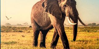
Once at Loiyangalani, the Sibiloi National Park further north along the shore can be reached. It is Kenya’s northernmost national park – a reason why it’s also one of its least visited, especially because of the long distances and rough roads. Its main attraction is the Koobi Fora Museum, the site where major palaeontological finds have been made. The museum holds the remains of several incredible-looking fossilised animals, in particular, elephant fossils that are estimated to be over two million years old. As for accommodation, the guidebook says there are three places: the KWS Alia Bay Guest House; the Koobi Fora Museum where there are several small chalets; the waterless Turkana Campsite.
But back to where our helicopter took us – the Mathews Mountain Range, the impressive hill country to the north of the Samburu and Shaba national reserves, with its thick forests and the amazing Kenyan Giant Cycads. The guidebook says that, if you want to visit by road, then your first target should be the one-street town of Wamba to its south. What you do after reaching Wamba the e-guidebook doesn’t say. I have a rally driver friend who visited the Mathews Range some years ago. I rang him to ask how he got there. He said ‘After Wamba, we just got horribly lost’. However, according to the printed guidebook, the place to stay is the Kitich Forest Camp and it is recommended that you ask for directions from Wamba when booking.
I reckon that the Kenya Rough Guide has a lot to interest Kenyans as well as foreign tourists. It describes places to visit across the whole country and there is information about routes and accommodation – from campsites to luxury hotels. Also, there are some fascinating sections about the country’s history, its writers and its musicians. It is now available at Bookstop in the Yaya Centre.
John Fox is Chairman of iDC Email: [email protected]