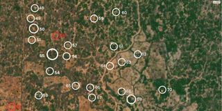
Do you know exactly where Shakahola Forest is located, its size or the distance from Malindi or other well-known places? Do you know exactly where the Ilemi Triangle is located? Suguta Valley? Baragoi? Bulo Mareer?
These are areas where some of the most important and dramatic stories have taken place in recent weeks and months. If you can’t locate and visualise the places, you are in good company.
Most newspaper readers need help to geographically place and contextualise news stories that take place in far-off or little-known localities.
Recently, Werner Zeppenfeld, of Msambweni, South Coast, suggested that the Nation use cartography for such news stories (See “We need geographical context”—Readers Have Their Say, Daily Nation, March 24, 2023)
Dr Zeppenfeld pointed out that it’s common for newspapers to use cartography to provide a geographical context for news stories. Journalistic cartography—or mapping the news—is, indeed, an old practice that began with reporting wars. Today, it is used to show graphically all types of news.
When stories take place in far-off places or are complicated, audiences need maps showing the localities. Stories that lend themselves well to mapping include territorial disputes, plane crashes, bank robberies and military operations. Big-quality newspapers, such as The Washington Post
Required map-reading skills
Unlike traditional maps, which required map-reading skills, journalistic maps are designed to be simple, easy and pleasant to read. In particular, they help the reader to visualise stories that are complex or take place in unfamiliar territories. They help to create a mental picture of the real world where an event took place. They tell stories in a way words cannot.
The Nation
One of them was the mapping of the stories about the maritime border dispute between Kenya and Somalia that erupted in 2021.
The stories could not have been effectively told without maps. One version of the story, by Sekou Owino, for instance, used a graphic map of the disputed maritime territory ( See “Economic interests are often at the root of border disputes”—Sunday Nation, October 17, 2021 ). Words alone could not have told the story as well.
But there are many more stories that should have been mapped but were not. These include the stories about the banditry and terrorist attacks in northern Kenya.
For example, “Security forces bomb bandits hideout in Baringo” by Fred Kibor, Geoffrey Ondieki & Florah Koech, published in the Daily Nation
Equally, “Elemi (sic) Triangle politics complicates operation to end banditry in North Rift” should have been mapped. The story, by John Kamau, was published in the Sunday Nation
The same could be said of many other stories that needed maps. These include the Baragoi massacre, in which 42 police officers were killed by bandits in Suguta Valley in Baragoi in November 2012.
The story that appeared in the Nation
As Dr Zeppenfeld says, editors should not assume that the average reader is well-versed in the geography of Kenya. Readers should not be expected to know all the localities and their geographical contexts. And they should not have to stop and look up Google Maps to understand where the action is.
Lone voice calling for journalistic values
I applaud your message in “Man kills over ugali: Tales we like to report and readers love to read” in the Daily Nation of May 19.
In the early 1990s, I was a contributor to a government-run rural newspaper in western Kenya called Nyota Ya Magharabi, based in Vihiga. This was my conundrum at that time.
The editorial team insisted on reporting on alarmist, “news-worthy” reports about rape, incest and bestiality with chicken! These torrid stories, as you have rightly pointed out, held some interest for many readers and sold the 16-page paper widely in the local markets.
I was the lone voice in calling for higher journalistic values. My calls fell on deaf ears. I agree there is really more to these stories, and cherry-picking angles that “sell” does a grave injustice to communities.
Article on ‘Today in History’ was spot on
“‘Today in History’ should be short as sweet and, above all, accurate” (Daily Nation, May 26, 2023) was such a timely article. Pictures, photos and glaring mistakes have been bringing confusion to this column, although, all in all, Anniel Njoka and Delvin Omwondo are doing a good job. Let them continue.
— Nicholas Murithi, Nyeri
Thank you for your article on ‘Today in History’. The Saturday, May 27, 2023 edition, again, did not click. It had “President Moi has issued a directive that no religious sect will be registered as a political party ...”. That was in 1992.
Back in 1985 on the same day, the country woke up to news of the shocking murder of then-Gem MP Horace Owiti. The events following the death were equally shocking for, a few days later, the man Owiti beat in the 1983 snap polls was arrested and died in police custody.
Column that alerts readers of scams
Some years ago, the Daily Nation used to have a column titled “When the deal is too good”. I have been reading of people being conned, among them a lawyer and a policeman. The column was very educative and saved many would-be victims. It alerted readers of the latest scams.
And now the digital paper: After a lot of complaints, the e-paper is now okay with complete pages and changeable fonts. Keep it up.
Let’s have ‘Letter from USA’ as well
Why not publish a “Letter from America” , just as you do “Letter from London” in the Sunday Nation?
— Alnashir D. Walji, Nairobi
The Public Editor is an independent news ombudsman who handles readers’ complaints on editorial matters, including accuracy and journalistic standards. Email: [email protected] . Call or text 0721989264