Premium
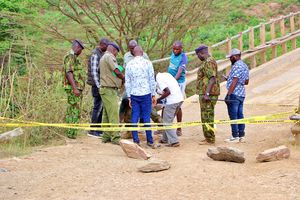
Geologists investigate huge cracks and earth movements in Nakuru
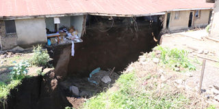
Damaged houses in Nakuru's Kaptembwo Estate after fissures formed last week.
What you need to know:
- These spots are just one of the many weak spots in the Great Rift Valley which runs from the Horn of Africa to Mozambique.
- In Kaptembwo, the fissures damaged houses while tenants were inside last week while in Kiambogo, farms were left with huge cracks.
The government has deployed senior geologists to Nakuru for more detailed studies after massive earth movements left deep fissures in different parts of the county.
Deep ditches have formed in the Kiambogo area after heavy rains, causing tension in the surrounding villages. Kaptembwo, Ngata and London areas also recently experienced huge cracks and fissures cutting across people’s farms and estates.
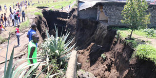
In Kaptembwo, the fissures damaged houses while tenants were inside last week while in Kiambogo, farms were left with huge cracks.
These spots are just one of the many weak spots in the Great Rift Valley which runs from the Horn of Africa to Mozambique.
In Kaptembwo, the fissures damaged houses while tenants were inside last week while in Kiambogo, farms were left with huge cracks.
Mining Principal Secretary Elijah Mwangi said a warning advisory has been shared with locals living in the affected areas.
Mr Mwangi explained that geologically, Nakuru County is located in an area prone to various geohazard types including sinkholes, landslides and earthquakes.
This means the county lies in an area where geological processes are most active
“The western part with its complex network of underground drainage channels draining through porous unconsolidated pumice and volcanic ash is most prone to such hazards. These drainage channels create significant susceptibilities on the structural integrity of the land by forming subterranean tunnels and cavities which ultimately result in the creation of sinkholes that damage property and roads,” the PS said.
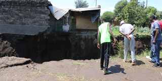
Nakuru County is located in an area prone to various geohazard types including sinkholes, landslides and earthquakes.
He said the county has had reports of sinkholes in the past.
A sinkhole was reported in 1972 and 1981 at Roundabout near O’Jais Petrol Station.
After the El Nino rainfalls of 1997, sinkholes appeared in London Estate.
In 2004, a similar incident occurred at TimSales Compound and Timber Mill Road.
Areas with weakness along the rift valley have been forming fault lines and fissures which are normally filled with volcanic ash.
But the recent rains have aggravated the situation by washing away that volcanic ash, exposing the cracks.
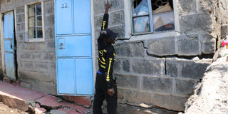
A cracked house in Nakuru's Kaptembwo Estate after fissures formed on the week of May 10, 2024.
“Currently, twin sinkholes have been reported in the Manyani area in Nakuru County. Preliminary geo-hazard analysis indicates the sinkholes could have been caused by excessive water whose natural flow along the surface was impeded by poor drainage. The water percolated into the porous volcanic ash and joined the pre-existing underground drainage channels resulting in the hollowing-in of the earth's surface.
“As department’s geo-physicists continue to enhance surveillance on other geological vulnerabilities that might occur, immediate intervention to avoid accumulation of excess water on the surface calls for construction of adequate storm drains and waterways within the town and residential areas to allow free and fast flowing of water to destination water bodies,” Mr Mwangi said.
Nakuru residents in high-risk areas have also been asked to report any sign of earth disturbance.
In 2018, a section of the busy Mai-Mahiu-Narok road near Suswa was split into two after heavy rains. Suswa lies at the bottom of the Rift Valley.
Plate tectonics, or shifting of the earth’s crust is based on the argument that the earth’s outer shell is divided into several plates that glide over the mantle which is the inner layer above the core.


