Premium
Kenya on high alert after Tanzania hit by Cyclone Hidaya

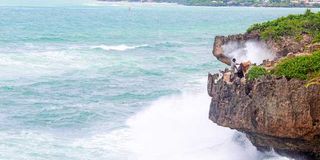
A homeless man at the edge of a cliff at Mama Ngina Waterfront in Mombasa County on May 4, 2024.
What you need to know:
- The cyclone danger usually comes from strong winds, waves, heavy rains and flooding.
In the past decade, the number of reported deaths due to tropical cyclones worldwide is 19,638.
Kenya remains on high alert after Tropical Cyclone Hidaya slammed into the Tanzanian coast, triggering a series of precautions as the country braced for the after-effects even if it were not to be hit directly by the storm.
On Saturday, Interior Cabinet Secretary Kithure Kindiki banned fishing, swimming, non-essential transport, and other beach activities until Monday at midnight, when the worst threat of the cyclone is expected to end.
In a statement, Professor Kindiki said unnecessary activities should be avoided along the beaches and within settlements adjacent to the shoreline.
“The government cautions members of the public against engaging in fishing, swimming and leisure activities within Kenya’s territorial waters and the beaches of Kwale, Mombasa, Kilifi and Lamu counties because of the possibility of risk to life and property within these areas,” said Prof Kindiki.
Were the cyclone to hit Kenya, the CS said, it could generate massive precipitation with strong winds and powerful waves capable of significantly disrupting normal activities.

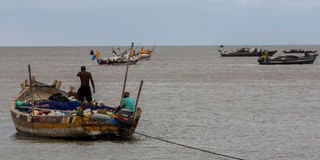
Tanzanian fishermen sail on their boat in the Indian Ocean as they prepare for the effects of tropical cyclone Hidaya in Bagamoyo District in the Coast region, Tanzania May 4, 2024.
“The County Security and Intelligence Committees of Kwale, Mombasa, Kilifi and Lamu counties in collaboration with the Kenya Coast Guard Service are directed to immediately issue notices and to strictly enforce a ban on beach activities, fishing, swimming, non-essential transport within Kenya’s territorial waters and evacuate settlements deemed too close to the shoreline effective today May 4, 2024 (yesterday) at 5pm up to and until midnight on Monday, May 6, 2024 when Cyclone Hidaya is expected to expire,” Prof Kindiki announced.
Last evening, Mombasa Governor Abdulswamad Nassir suspended construction work, beach activities and fishing immediately until midnight tomorrow due to the expected after-effects of Cyclone Hidaya.
“No one is allowed to access the beaches. This is a direct order. We cannot have construction while we are in the eye of the storm. We would rather lose a house than humans. We would rather be safe than sorry. Let us all do what needs to be done,” said Mr Nassir.
The governor said the county is liaising with the police, Kenya Navy, national government, road agencies, the Kenya Ports Authority and the Kenya Coast Guard Services.
The cyclone danger usually comes from strong winds, waves, heavy rains and flooding.
In Africa, countries like Mozambique, Malawi and Zimbabwe have previously been hit by cyclones that left hundreds of people dead and in urgent need of assistance.
In the past decade, the number of reported deaths due to tropical cyclones worldwide is 19,638.
This, even as the number of tropical cyclones globally has increased continuously in the past half a century.
The Kenya Meteorological Department on Saturday indicated that the country would only suffer the after-effects of the cyclone hitting the Tanzanian coast, and would not be directly hit by the cyclone itself — which would have been the first ever in the country. The weatherman, however, urged caution.
“The cyclone will not hit our coast due to the physics laws governing cyclone formation, which are not applicable within 480 km from the Equator,” the Kenya Meteorological Department said yesterday afternoon.
Another depression
This came with a warning that experts were monitoring the situation: “Another depression is developing behind it (the cyclone that hit Tanzania), which the Kenya Meteorological Department is closely monitoring. Heavy rainfall is expected offshore along the Kenyan coast from Sunday, May 5, (today) intensifying on Monday, May 6, to Tuesday, May 7, 2024. The effects of the cyclone are already being felt offshore, with strong winds exceeding 40 knots (20.6 m/s) and large waves surpassing two meters. The department will continue monitoring the situation and issue updates as necessary,” the Met department said.
In 2019, the department had asked Kenyans to dismiss their fears after a similar cyclone hit the Mozambican coast.
“It is false that cyclone Kenneth will hit the Kenyan coast. By the laws of physics, cyclones cannot come this close to the Equator. Landfall will be northern Mozambique as shown in the satellite image,” the Met department told Kenyans in 2019.
Cyclone Kenneth was the strongest tropical cyclone to make landfall in Mozambique since modern records began.
Mr Samuel Kairo, an innovator at Telescopic Weather, a private weather monitoring unit, said that one has to visualise a giant whirlpool in the sky when thinking about a cyclone.
“Tropical cyclones are like massive spinning storms that form over warm ocean waters. They pack up a punch with strong winds that spiral around the centre. The earth’s rotation adds to a twist, empowering these storms to bring heavy rain and strong winds. It happened because of the extra warm water off the coast of Tanzania and north of Mozambique,” Mr Kairo says.
Ms Joyce Kimutai, a scientist and research associate at Imperial College London, adds that a tropical cyclone can only form after a particular surface temperature.
“It has to be 25 degrees and above. This means that the ocean is very warm at this time of the year,” she says.
Tropical cyclones, Mr Kairo explains, are a way of the ocean releasing excess heat. “It's a natural phenomenon where evaporation releases excess heat into the atmosphere.”
Picture a hot, sunny day. Tiny dust particles dancing chaotically in the wind, swirling upwards in bursts before falling back in lazy spirals. Tropical cyclones are like this on a massive scale, but instead of dust, they are giant swirling storms over warm ocean waters.
The winds spiral inwards at great speed, fuelled by the earth's rotation. In a tropical cyclone, the swirling air acts like someone squeezing a balloon. All that spinning air gets pushed upwards and outwards, leaving a region of lower air pressure at the centre, which is called the calm eye. Experts say that while on land, the centre of the eye is, by far, the calmest part of the storm, over the ocean, however, it's also possibly the most dangerous as waves from all directions slam into each other, creating massive waves that could go as tall as 40 metres.
They are called hurricanes when they form over the North Atlantic, Central North Pacific and Eastern North Pacific, and are labelled as typhoons when they form in the Northwest Pacific. If they are created over the South Pacific or Indian Ocean, they are known as cyclones.
Severe storm
The World Meteorological Organisation coordinates a system where different regions have committees that name storms. Each region uses lists of names that rotate on a multi-year basis. These lists are created considering cultural familiarity and ease of pronunciation. If a storm is particularly devastating, its name is retired from the list and no longer used in future.

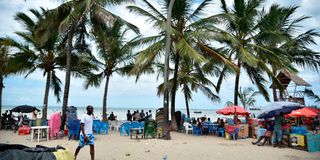
Beach operators at the Jomo Kenyatta Public Beach in Mombasa. The Coast region is likely to be hit by Cyclone Hidaya, which will result in heavy rainfall, large waves and strong winds. Kevin Odit.
Tropical Cyclone Hidaya was named by Meteo-France La Reunion, the meteorological agency responsible for monitoring weather in the South-western Indian Ocean.
Tropical cyclone Hidaya has reached a maximum speed of 165 km per hour and has been designated as tropical cyclone category one, which is a severe storm.
However, it has since weakened as it moves north and it is now a tropical storm as at yesterday afternoon, it sustained winds at 135 km per hour. Models indicate that it weakening quite substantially.
World Meteorological Organisation defines a tropical cyclone as “a rapidly rotating storm that begins over tropical or subtropical oceans, with very violent winds and torrential rain; sometimes accompanied by thunderstorms.”
“A tropical cyclone has a low-pressure centre and clouds spiralling towards the eyewall surrounding the "eye", the central part of the system where the weather is normally calm and free of clouds. Its diameter is typically around 200 to 500 km but can reach 1000 km. A tropical cyclone brings very violent winds, torrential rain, high waves and, in some cases, very destructive storm surges and coastal flooding. The winds blow counter-clockwise in the Northern Hemisphere and clockwise in the Southern Hemisphere. Tropical cyclones above a particular strength are given names for public safety,” the organisation says on its official website.
In terms of just how damaging a cyclone can be, the world weather monitoring body says the “cyclones can be hundreds of kilometres wide and can bring destructive high winds, torrential rain, storm surges and occasionally tornadoes.”
The winds can reach speeds as high as 300 km/h and “the combination of wind-driven waves and the low-pressure of a tropical cyclone can produce a coastal storm surge – a huge volume of water driven ashore at high speed and with immense force that can wash away structures in its path and cause significant damage to the coastal environment. Torrential rainfall results in flash-flooding and potential landslides and mudslides.
Additional reporting by Brian Wachira


