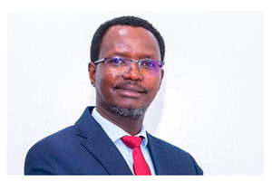
Healthy soils are the foundation of food production. However, land degradation, declining soil fertility and climate change continue to threaten agricultural productivity across Kenya. To address these challenges, farmers are embracing digital soil mapping initiative to generate reliable soil data that will help them make informed decisions on crop selection, fertiliser application and sustainable land management. Seeds of Gold writer spoke to Dr Barack Okoba, National Coordinator for the Soil Mapping for Resilient Agri-food systems (SoilFER), on how the initiative will transform soil management, improve agricultural productivity and strengthen climate resilience.
Take us through the SoilFER programme and explain how it will help farmers make future informed farming decisions.
The Soil Mapping for Resilient Agrifood Systems (SoilFER) programme is a timely intervention supporting seven countries in Africa and Central America.
Its main objective is to strengthen national soil information systems and promote the use of reliable soil data to improve soil fertility, agricultural productivity and resilience.
The programme focuses on strengthening national soil data and laboratory systems, building technical capacity, and helping farmers and decision-makers translate soil information into practical recommendations for improved soil and fertiliser management.
Ultimately, farmers will have access to reliable information that enables them to understand their soils, select suitable crops and apply the right inputs in the right quantities.
Several activities are being implemented to strengthen soil governance, improve laboratory services and equip farmers with practical soil management knowledge.
These include the establishment of the National Soil Partnership (NSP), which brings together stakeholders to improve coordination in soil health and management.
We are also strengthening the National Soil Laboratory Network (NASOLAN) to enhance collaboration, promote quality standards and build technical capacity among soil laboratories.
Another major activity is the national rollout of the Global Soil Doctors Programme (GSDP), which equips farmers and agricultural extension officers with practical knowledge of sustainable soil management.
In addition, NASOLAN members are meeting to discuss laboratory capacity, training, governance and the development of a strategic roadmap for 2026–2027.
These interventions are intended to ensure that soil information is reliable, accessible and useful to farmers, researchers and policymakers.
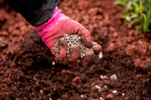
More than 40 per cent of soils across East Africa are degraded, and in Kenya the picture is worse.
Photo credit: Shutterstock
Geographically referenced soil databases are essential because they provide detailed information about soil characteristics and their distribution across different locations.
Through precision agriculture and variable-rate input application, soil maps can reveal variations in fertility, pH, texture and organic matter, even within a single field.
This enables farmers to apply fertiliser, agricultural lime and water precisely where they are needed, instead of using uniform application rates across an entire farm.
Such an approach can reduce production costs, improve nutrient-use efficiency and minimize chemical runoff.
Digital soil information can also support better irrigation management by helping farmers determine appropriate water application rates and schedules, reducing the risks of overwatering or underwatering.
Through SoilFER, Kenya has completed a nationwide soil sampling campaign, collecting more than 3,500 georeferenced soil samples.
The samples will support more precise fertilizer recommendations, strengthen agricultural advisory services and inform evidence-based policymaking.
We are working to strengthen the capacity of soil laboratories nationwide through a series of physical and virtual training programmes.
Our objective is to ensure that laboratories adopt standardised procedures for soil analysis and produce reliable, comparable results.
Some laboratories may have equipment that has not been adequately validated or calibrated to ensure that it operates according to the required standards.
We are therefore training soil scientists, particularly laboratory personnel, to improve the quality and consistency of their work.
Through the Kenya Soil Laboratory Network, participating laboratories are being brought together to strengthen collaboration and promote standardized analytical procedures.
Laboratory professionals register through the FAO's voluntary membership platform, after which they can participate in training and capacity-building activities.
For instance, laboratories may be provided with a soil sample to analyse using their respective procedures. The results can then be compared to assess their performance and identify areas that require improvement.
This process helps strengthen confidence in the soil data generated by laboratories across the country.
How long will it take to analyse the soil samples, and how will the technology improve the process?
Traditionally, soil analysis has relied heavily on wet chemistry, which involves using chemical reagents and carrying out laboratory procedures to determine soil properties.
Under SoilFER, we are exploring the use of both wet chemistry and dry chemistry to analyse the soil samples and develop models that can support faster soil assessment.
Dry chemistry techniques use methods such as spectral reflectance, whereby a machine scans a soil sample and analyses how it reflects light to estimate its properties.
We will use results from conventional laboratory analysis alongside those generated through these scanning techniques to train and calibrate the models.
The nationwide collection of more than 3,500 soil samples will provide an important foundation for this work.
Once the models have been adequately trained and validated, the technology has the potential to analyze soil samples much faster than conventional methods.
This would significantly reduce the time required to analyse samples and generate soil management recommendations.
However, the accuracy of these results will depend on proper calibration, validation and the reliability of the models developed.
Once soil data has been collected in a particular area, can another farmer in the same locality access and use that information?
Yes. The intention is to make the information publicly accessible through a digital platform, enabling farmers and other users to obtain relevant soil information.
The platform is expected to use location information to help users identify the soil characteristics and agroecological conditions of the areas where they farm.
We also intend to integrate different datasets, including soil information, climate data, rainfall patterns and crop suitability information.
This will help farmers make more informed decisions about the crops they grow and the management practices they adopt.
However, farmers should understand that soil conditions can vary even within the same locality. Therefore, information from a nearby farm may provide useful guidance, but it may not always substitute for testing soil from an individual farm.
The more accurately the information reflects the conditions on a farmer's land, the more useful it will be in supporting appropriate farming decisions.
The initiative brings together several institutions working to strengthen soil information systems and improve sustainable soil management.
The Food and Agriculture Organization of the United Nations is supporting the programme in partnership with the Ministry of Agriculture and Livestock Development and the Kenya Agricultural and Livestock Research Organization.
The programme is funded by the Food and Agriculture Organization of the United Nations (FAO), with support from the United States Department of State.
We are also working with stakeholders through the Kenya Soil Partnership, which brings together government institutions, academia, the private sector and development partners to strengthen soil governance.
The Kenya Soil Laboratory Network is another important partner, helping to improve collaboration, promote quality standards and build technical capacity among laboratories nationwide.
Beyond improving crop selection and pre-planting planning, what practical milestones have you achieved so far?
One of the major milestones has been the unveiling and handover of Kenya's upgraded National Reference Soil Laboratory and Geographic Information System (GIS) Laboratory at KALRO.
The upgraded facilities represent an important investment in strengthening the country's capacity to conduct reliable soil analysis, undertake digital soil mapping and generate information that can support farmers, researchers and policymakers.
We have also undertaken a nationwide soil sampling campaign, collecting more than 3,500 georeferenced soil samples to support the development of more precise fertiliser recommendations and improved agricultural advisory services.
Another milestone is the national rollout of the Global Soil Doctors Programme, which equips farmers and extension officers with practical knowledge of sustainable soil management.
Through this programme, farmers can learn how to assess soil health, identify soil fertility challenges and adopt appropriate management practices to improve productivity.
We have also engaged farmers participating in the Global Soil Doctors Programme to understand how science-based soil management can improve agricultural productivity and livelihoods.