For many Kenyans, August has become a month of jackets, blankets and unusually chilly mornings.
In Nairobi and the central highlands, chilly conditions have persisted into the day, raising questions about why temperatures remain low as the country approaches the end of the dry season.
But the cold is not unusual for August. It is part of a seasonal pattern driven by the movement and strengthening of large atmospheric pressure systems in the Southern Hemisphere.
In an exclusive interview with Climate Action , Christine Maswi, Principal Meteorologist at the Kenya Meteorological Services Authority (KMSA), says that August is climatologically one of Kenya's colder months, with the cooler conditions beginning in June and normally easing towards the first or second week of September.
“Climatologically, August is considered a colder month because it falls within the country’s cooler season, when the southeast trade winds bring cool, moist air from the Indian Ocean,” she said.
Climatology looks at long-term weather patterns to establish what conditions are considered normal for a particular place and season.
“Climatology is the analysis of weather patterns over a period of 30 years or more,” she explained.
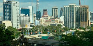
No building has defined the Nairobi skyline more than KICC. Photo/ MARTIN MUKANGU
The explanation begins thousands of kilometres south of Kenya, where it is currently winter.
As temperatures fall across the Southern Hemisphere during its winter, large high-pressure systems become stronger. These systems influence the winds that move northwards towards East Africa, carrying cooler air with them.
The two major systems include the St Helena pressure system over the antlantic ocean which is the south-western part of African Continent and the Mascarene pressure system which is over the south-eastern part of the continent, regions around Madagascar.
The St Helena High sits over the south-western part of the continent, while the Mascarene High occupies the southeastern side, over the Indian Ocean.
“These are over the Southern Hemisphere,” Maswi said, “the two systems become particularly important during the southern winter.”
When the high-pressure systems south of Kenya strengthen, they help push cooler air northwards towards East Africa.
“As these systems intensify, as they become much stronger, they pump in cold air from the south,” she explained, “this is why Nairobi, the central highlands and parts of eastern Kenya can feel particularly cold during June, July and August.”
The affected areas include parts of Machakos, Makueni, Kitui and Taita Taveta, where residents can experience chilly mornings and, on some days, temperatures that remain low for much of the day.
The process is also linked to the position of the Equator. Warm air around the equatorial region rises, creating conditions that allow cooler air from the south to move in.
“The cold air from the south rushes in to occupy the warm air that is left,” she said.
That movement is reinforced by the seasonal winds known as the southern monsoons, which help transport the cooler air towards Kenya.
However, the pressure systems do not remain equally strong throughout the day or from one day to another.
According to KMSA, their changing intensity helps explain why August weather can sometimes feel unpredictable.
“One day may begin bitterly cold before temperatures rise in the afternoon,” she explained, “the following day may remain cloudy and chilly.”
Ms Maswi emphasised that the difference is partly explained by fluctuations in atmospheric pressure. “When they weaken, they allow in flow of warm air into our region."
The result is a weather pattern in which cold and relatively warm conditions can alternate within short periods.
“That is why the cold experienced in August should not necessarily be interpreted as evidence that the whole country is experiencing an abnormal drop in temperatures.” She emphasised.
KMSA's June-July-August outlook anticipated cool and cloudy conditions over the Highlands East of the Rift Valley, including Nairobi and parts of the southeastern lowlands, during July and August and into the first half of September.
At the same time, the broader outlook projected temperatures to be warmer than usual across the country.
However, the contradiction paints a different picture. A region can experience persistently cold mornings and cloudy days while the country's overall temperature signal remains warmer than the long-term average.
The Mascarene High, in particular, is a major subtropical high-pressure centre over the southwest Indian Ocean.
Research on the system shows that its location shifts during the Southern Hemisphere winter and that changes in its strength can affect atmospheric circulation over the wider region.
The St Helena High similarly forms part of the large-scale circulation over the South Atlantic and is strongest around the southern winter months.
Together with other large-scale pressure systems affecting Africa, these atmospheric features help determine where air masses move and how strongly winds reach East Africa.
However, according to meteorologists, this year's weather is unfolding against a changing global climate backdrop, including the development of El Nino.
“Kenya has been experiencing alternating spells of warm and cold weather,” she explained, “due to the interaction between seasonal pressure systems and the developing El Nino conditions.”
She further added that the strength of the southern hemisphere pressure systems, particularly the Mascarene and St Helena highs, determines how much warm or cold air reaches the country.
Maswi said El Nino conditions are currently strong, with an estimated 80 per cent likelihood of the phenomenon during the October-November-December rainfall season.
The warming of sea-surface temperatures associated with El Nino, she explained, can contribute to periodic warm conditions experienced during the June-to-September period.
“Depending on the June, July, August season, it tends to bring drier weather conditions, especially over the western part of the country,” Maswi said.
She linked the dry conditions in parts of western Kenya to crop failures reported in the region, while noting that El Nino's influence changes during the October-December rainfall season, when it can result in enhanced rainfall.
KMSA says it is closely monitoring the phenomenon, which is expected to have important implications for Kenya later in the year.
“El Nino is not rain,” Maswi explained, “it's just a condition that leads to enhancement of rain.”
El Nino refers to an abnormal warming of sea-surface temperatures in the central and eastern tropical Pacific Ocean, accompanied by changes in atmospheric circulation.
For Kenya, however, El Nino's effects depend heavily on the season.
That is significant because parts of western Kenya have already experienced poor rainfall and crop failures.
But the situation can reverse during the October-November-December season, when El Nino is associated with enhanced rainfall over much of East Africa.
“The cold August mornings being experienced in Nairobi should not automatically be blamed on El Nino.” She explained. “The immediate cause, according to KMSA, is primarily the seasonal atmospheric circulation and the strengthening of pressure systems south of the Equator.”
For now, KMSA expects the cooler conditions to remain part of the Kenyan weather pattern into early September.
Central Kenya is expected to retain its characteristic cool and cloudy conditions, while Nairobi is likely to experience intermittent rainfall. Other areas, particularly parts of northern and eastern Kenya, are expected to remain largely sunny and dry.
The August outlook points to near-average to below-average rainfall in several areas, including western Kenya, parts of the Rift Valley and sections of the Coast. Turkana, Samburu and parts of West Pokot, Elgeyo Marakwet and Baringo are expected to experience below-average rainfall.
Marsabit, Wajir, Mandera, Isiolo, Garissa, Machakos, Kitui and Makueni are expected to remain largely sunny and dry.
“The seasonal chill normally begins easing towards the first or second week of September,” Maswi explained, “as the atmospheric circulation changes and warmer air begins to return.”