Brace for El Nino, UN warns
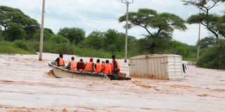
Boats provide public transport between Madogo town in Tana River and Garissa on May 6, 2024.

For Kenyans who remember the floods of late 2023 and 2024, the word El Niño is not an abstraction. At least 245 people died, more than 78,000 households were affected, and nearly 46,000 households were displaced as the last event tore through the country. Forty-two of Kenya’s 47 counties were touched. The images of entire villages underwater, of roads simply gone, of families picking through mud for what was left, are not old memories.
Now the cycle is about to start again.
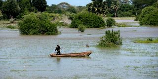
A local peddles through a flooded homestead along the Garsen- Witu Road in Tana River County in this photo taken on May 14, 2026.


On Tuesday, the World Meteorological Organization confirmed what its models have been tracking for weeks.
“We need to prepare for a potentially strong El Niño event, which will exacerbate drought and heavy rainfall and increase the risk of heatwaves both on land and in the ocean,” said WMO Secretary-General Celeste Saulo. “The most recent El Niño, in 2023-24, was one of the five strongest on record and it played a role in the record global temperatures we saw in 2024.”
The UN Secretary-General was less measured. “The science is clear: El Niño is arriving on our doorstep in the coming months with 90 per cent certainty,” António Guterres said in a video statement. “The world must treat it as the urgent climate warning it is.”
For Kenya, however, the story is not as simple as bracing for floods. El Niño hits the country in two distinct phases, and understanding which phase we are in right now matters, especially for farmers, planners and anyone living in a flood-prone area.
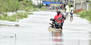
Citizens attempt crossing Chad Road in Syokimau after a heavy downpour left roads unpassable.
The next three months: drier, hotter, stressed
The Kenya Meteorological Department issued its June-July-August 2026 seasonal forecast on May 30, five days before the WMO went public with its alert. The two documents tell the same story from different angles.
The JJA forecast season, rainfall in the Highlands West of the Rift Valley, the Lake Victoria Basin, the Rift Valley and Northwestern Kenya is forecast to be “near-average to below-average,” with “intermittent dry spells expected throughout the season.”
The department’s El Niño statement, issued separately, explains why: “During June, July and August, El Niño is typically associated with depressed rainfall over most parts of Kenya.”
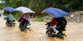
Boda boda operators ferry passengers on a flooded road in Junda area following a heavy downpour in Mombasa on April 22, 2026.
The JJA forecast also projects “warmer than average temperatures over the whole country,” with the western highlands, the Lake Victoria Basin and the Coast carrying the highest probabilities of above-normal heat. In farming areas already contending with reduced moisture, those two signals working together threaten crop yields going into the second half of the year.
The forecast also flags that cool and cloudy conditions in the highlands “may delay crop maturity,” while “strong winds in the eastern parts of the country may physically damage crops and increase evapotranspiration.”
The one region that gets relatively better news is the Coast. Mombasa, Kilifi, Kwale and Lamu counties are forecast to receive near-average to above-average rainfall. The forecast notes this “is likely to benefit from near-average to above-average rainfall that is expected to provide moisture for the growth of crops.”
For the rest of the country, the next three months ask for careful management of what water there is.
October Is When El Niño Shows Its Other Face
In Kenya, the most consequential period of an El Niño event is typically not June-July-August. It is October-November-December (OND season).
“During October, November and December, El Niño is generally associated with increased (enhanced) rainfall,” Kenya Met says.
Asked whether this meant flooding on the scale Kenya experienced in 2023-24, Dr Chris Kiptum, a climate scientist at Kenya Meteorological Department, did not dismiss the concern.
“There will likely be enhanced rainfall, which will likely lead to flooding in poorly drained urban areas, riverine areas and flood prone areas,” he said. “The impact is especially likely to be experienced later in the year during the OND season.”
The Wildcard: The Indian Ocean Is Not Cooperating With Certainty
Whether the OND season turns catastrophic or merely difficult depends significantly on a second climate system that Kenya Met has been careful not to ignore. The Indian Ocean Dipole, which measures the temperature difference between the western and eastern tropical Indian Ocean, interacts directly with El Niño to determine rainfall outcomes over the Greater Horn of Africa.
The Kenya Met El Niño statement explains the dynamic: “A positive IOD is associated with enhanced rainfall during October to December. A negative IOD is associated with depressed rainfall during October to December.”
Currently, the IOD is neutral, sitting at an index of -0.34°C as of late May. The department says most models indicate it will stay neutral through August, but that a positive IOD event is possible between July and November. The problem, as Kenya Met acknowledges openly, is uncertainty: “Model forecasts show a large variation in both timing and strength of this potential event.”
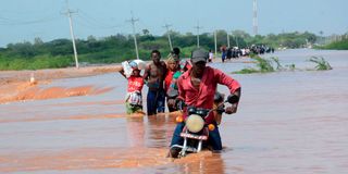
Transport disrupted at Gamba area in Tana River as floods causes havoc in the county on December 3, 2023.
If both El Niño and a positive IOD develop simultaneously in the second half of 2026, the combination would be similar to what drove the 2023-24 disaster. If the IOD stays neutral or turns negative, the picture is different. Right now, nobody can say with confidence which way it goes. Kenya Met says it will keep providing monthly updates and it will issue the OND 2026 forecast in late August or early September.
A Decade of Lessons Kenya Keeps Relearning
This is not the first time Kenya has been here. Three significant El Niño events in the past decade have each extracted a toll, and each time the damage has been at least partly traceable to the same vulnerabilities: poor drainage in urban areas, settlements in flood-prone zones, inadequate early warning at the last mile, and a mismatch between the forecasts that exist and the decisions that get made.
The floods of 2024 killed hundreds of people as intense downpours submerged homes, washed away crops, and destroyed critical infrastructure such as roads and bridges. Scientists described a deadly combination of man-made climate change and cyclical El Niño weather as the driver. One of the findings from that period was that drought conditions had left arid soil unable to absorb water, turning rainfall that might otherwise have been manageable into floods and landslides.
The 2015-16 El Niño, rated among the strongest globally in the modern record, brought a different set of problems. Severe drought hit the arid and semi-arid north while flooding struck the coast and highlands. The lesson both events delivered was the same: El Niño is not a single event with a single consequence. It is a seasonal pattern with layered effects, which play out differently across Kenya’s highly varied geography.
“El Niño does not have to be a recipe for disaster,” Saulo said. “Forecasts such as what WMO presents today are a call to action. With reliable and accurate forecasts and effective early warnings, we can anticipate impacts, take steps to reduce risks and act before hazards become crises.”
Follow our WhatsApp channel for breaking news updates and more stories like this.