There are crimes that announce themselves with bombast and scandal. And then there are silent but deadly crimes, committed in slow motion, over decades – crimes so vast and so quiet that by the time the bill arrives, the perpetrators are long dead or retired to comfortable obscurity.
The environmental destruction of Meru and Tharaka-Nithi counties is the second kind. It is a multi-generational act of collective suicide and its consequences are today knocking on the door.
To understand what has been lost, let’s look at what once existed.
In 1960, the eastern slopes of Mount Kenya above Meru and Tharaka-Nithi were among the most ecologically endowed landscapes in East Africa.
The Mount Kenya Forest Reserve, of which Imenti Forest is the northeast anchor, stretched across a largely intact montane ecosystem covering an estimated 4,779 square kilometres. The forest was dense, cathedral-dark and ancient – a canopy of camphor, Meru oak, African pencil cedar and East African yellow wood, many of them centuries old. I walked this cathedral with my grandfather when I was a child. And even though he had lived around it for nearly a century and was stronger and faster when running away from elephants than me, he warily looked into the darkness with fear and suspicion.
Above the treeline, 18 glaciers crowned the summit. The mountain was a water factory, a priceless heirloom. The glaciers and forest together fed a network of permanent rivers and streams tumbling down the mountain’s slopes – the Tana, Ewaso Nyiro, Kathita, Thanantu, Nithi, Ura and scores of smaller streams that kept the lowlands green the year round. Annual rainfall across the upper Meru highlands averaged 1,300mm or more, supporting two reliable growing seasons, abundant groundwater and a biological richness that is now a distant memory. The area receiving adequate rainfall to support reliable rain-fed agriculture extended well to the east and north of the central highlands. Meru was food-surplus country.
The attack came in waves. The first was colonial and post-independence agricultural expansion, the steady clearing of forest margins for smallholder farms and tea estates, replacing indigenous canopy with crops and eventually with bare, exhausted soil. The second was charcoal burning, that slow-motion fire that has consumed Kenya’s forests for half a century, each sack sold for a few hundred shillings while the soil compacts and the water table drops. The third, and perhaps the most cynical, was the looting of Kenya’s indigenous hardwood for export on an industrial scale.
TRAFFIC, the wildlife trade monitoring network, has documented how Kenya’s highland forests were systematically stripped of their most valuable timber species, with logs processed and shipped to the Gulf states for furniture and construction. Indigenous tree species remain the most targeted products in Kenya’s forest crime networks, with rosewood, sandalwood and red cedar increasingly threatened with extinction. The trees that took three centuries to grow were felled in one afternoon. The timber was loaded onto dhows, the money went to Mombasa brokers and Gulf merchants, and the mountain left to bleed.
The Mt Kenya ecosystem lost one-fifth of its forest cover in a single decade, according to research published in Environmental and Sustainability Indicators (2025). Tharak- Nithi County now retains only 27,000 hectares of natural forest, barely 11 per cent of its land area. Across Kenya, forest cover has fallen from 10 per cent at independence to 6 per cent today, with 12,000 hectares lost every year. Of the 18 glaciers that crowned Mount Kenya, only 10 remain. The mountain has lost more than 95 per cent of its glacial area. The Lewis Glacier, once the largest, covered 0.49 square kilometres in 1934. By 2018 it had shrunk to 0.04 square kilometres. By 2024, only 6.9 hectares of ice remained. Scientists say it will be gone entirely by 2030.
Meru and Tharaka-Nithi are running out of water. The long rains in central Kenya have declined by more than 100mm since the mid-1970s, according to the United States Geological Survey’s Climate Trend Analysis, and the 500mm boundary of viable rain-fed agriculture has shrunk by approximately 15km per decade, retreating from Meru’s hinterlands year after year. The area receiving adequate rainfall to support reliable rain-fed agriculture in central Kenya has declined by roughly 45 per cent since the mid-1970s and the rivers are going with it.
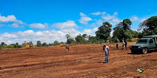
Yesterday, Meru leaders feasted at Meru Slopes Hotel to celebrate their “success” at holding a posthumous public participation session to clear 100 acres of forest in defiance of court orders. What was there to celebrate? Those who want to protect the forest are not opposed to development. They are offering free land for it: in Ntirimiti, next to the forest, for the State lodge, 300 acres of Meru University land for the golf course and Gaitu for the airstrip. Why must the forest be destroyed?