Kenya Met: Coast flooding driven by off-season storms, not El Niño
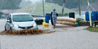
Motorist drive through a flooded road in Ukunda town, Kwale County following heavy rains on September 11, 2026.

What you need to know:
- Kenya Meteorological Services Authority has said despite the flooding El Niño has not arrived.
- According to the World Meteorological Organisation, an El Niño isn't a storm, or even a season.
If you've been at the Coast this past week, you've seen the flooding. Roads underwater, compounds swamped, people asking the same question everywhere: is this it? Has El Niño finally arrived?
The Kenya Meteorological Services Authority's answer, through climate scientist Chris Kiptum, is no. Not for the Coast, not yet. What's falling right now is something else entirely.
"The recent rainfall over parts of the Coast is not related to El Niño-enhanced OND rains," Kiptum said. "Instead, it is driven by off-season, localised storms resulting from moisture-laden southeasterly winds blowing from the Indian Ocean.”


So what's actually causing the rain?
Start with a basic idea: air moves from areas of high pressure to areas of low pressure, the same way water flows downhill. The bigger the difference in pressure between two places, the stronger the wind blowing between them.
Right now, there's a big, semi-permanent zone of high pressure sitting over the southern Indian Ocean called the Mascarene High. Near the equator, meanwhile, warm air is rising and creating a belt of low pressure that sits there more or less permanently. That gap between the two, Kiptum explained, is what's pushing wind toward Kenya's coastline right now.
“These are caused by the pressure gradient force between the Mascarene High pressure cell and the permanent low-pressure system at the equator,” he said.
In simple terms, the ocean is pushing wet, warm air onto the coast because of a pressure imbalance that has nothing to do with El Niño. It's a local weather event, not a seasonal one.
Before the rains hit, Kenya Met had issued a weekly forecast on the 7th September for the week of 8th to 14th September, which said: "Some parts of Lamu, Kilifi, Tana River, Mombasa, Kwale, Narok and Bomet Counties are likely to receive rainfall, most parts of the country are expected to be generally dry.”
The marine forecasts Kenya Met issues for ships and fishermen also repeated this. The bulletin covering 8th to 14th September recorded winds over Kenyan and Tanzanian waters blowing at up to 20 knots. A knot is a nautical mile per hour, so 20 knots is a little over 37 kilometres an hour. The next bulletin, covering 9th to 15th September, showed those winds picking up to 21 knots, with the sea itself getting choppier, described in the document as moving from "slight" to "rough" conditions with waves up to 2.5 metres high.
How much rain actually fell?
While social media is flooded with numbers of how much rain the locals believe they received, Kenya Met says the official readings from the gauge at Mombasa Airport were September 9: 6.8 mm, September 10: 30.2 mm, and September 11: 58.4 mm.
“Add that up and you get 95.4 mm over four days, almost all of it packed into the last three,” Kiptum says. "It remains below the 100 mm threshold.”
According to Kenya Met, anything under 5mm in a day is "light," basically a drizzle. Between 5 and 20mm is "moderate," the kind of steady rain you'd notice but wouldn't worry about. Between 21 and 50mm is "heavy," described in forecasting language is referred to as "intense rain, possible thunder."
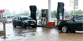
A flooded petrol station in Ukunda town, Kwale County following heavy rains on September 11, 2026.
Anything above 50mm is "very heavy," meaning "prolonged rain, high intensity."
By that scale, 10th September's 30.2mm was already a heavy rain day. 11th September's 58.4mm crossed into very heavy. So even without hitting 100mm, this was a serious rain event by Kenya Met's standards, but not extreme.
But Mombasa Airport is one weather station. A storm like this can dump very different amounts of rain within just a few kilometres. Someone in a different part of Mombasa, or in Kilifi or Kwale, where separate gauges record their own totals, could easily have experienced more rain and worse flooding than what the airport picked up.
So where does El Niño actually fit into this?
According to the World Meteorological Organisation, an El Niño isn't a storm, or even a season.
“It's a shift in ocean temperature happening thousands of kilometres away, in the Pacific, that ends up reshaping weather patterns everywhere, including here,” the organization says.
It works like this. Every few years, the surface waters of the central and eastern Pacific Ocean, near the equator, warm up more than usual. That extra ocean heat changes how air moves above it, which in turn nudges rainfall and temperature patterns all over the planet, including how much moisture ends up flowing toward East Africa. When that happens, Kenya typically gets wetter-than-normal conditions during its October to December short rains season, known locally by the shorthand OND.
WMO, the United Nations' weather agency, has been tracking this year's event closely and describing it in increasingly urgent terms.
“El Niño is firmly established and will intensify into a very strong event in the coming months, with big impacts on rainfall and temperature patterns and associated risks of floods, drought and extreme heat,” WMO said in an updated issue in early September.
The agency puts the odds of El Niño lasting all the way through to February 2027 at close to 100 per cent.
WMO Secretary-General Celeste Saulo has framed it as a call to prepare rather than panic. "We need to prepare for a potentially strong El Niño event, which will exacerbate drought and heavy rainfall and increase the risk of heatwaves both on land and in the ocean," she said, pointing out that the last comparable event, in 2023 and 2024, was one of the five strongest on record.
"According to the KMSA OND 2026 forecast, these rains will continue through September over western Kenya and are expected to begin in October across most other regions, including the Coast,” Kiptum said.
So this week's flooding and the much bigger rains still to come are, for now, two separate events that happen to be arriving close together on the calendar.
Follow our WhatsApp channel for breaking news updates and more stories like this.