Kenya is bracing for three types of flooding during the October-November-December (OND) rains, with the strengthening El Niño conditions threatening homes, infrastructure, livelihoods and food systems across the country.
A preliminary government assessment estimates that 1.5 million people in all 47 counties could be affected, although the full report on national preparedness has yet to be released.
The World Meteorological Organization (WMO) says there is an “exceptionally high likelihood of nearly 100 per cent” that El Niño conditions will persist through February 2027. In Kenya, the phenomenon is associated with above-normal rainfall in many areas.
The Kenya Meteorological Service Authority (KMSA) has identified urban, riverine and flash flooding as the main threats, depending on terrain, drainage systems and proximity to rivers and other water bodies.
“We are looking at urban flooding, riverine flooding and flash floods,” said Zachary Mwai, assistant director in charge of Hydrometeorological Services at KMSA.
A source at the Office of the Deputy President, which is coordinating the Government’s response through an ad hoc El Niño committee, said the preparedness assessment was still being finalised.
Kenya Met has already mapped areas where heavy rainfall, swollen rivers, poor drainage and normally dry river channels could combine to create dangerous conditions.
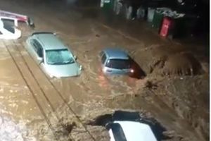
Nairobi faces a significant urban flooding threat because extensive concrete surfaces prevent rainwater from soaking into the ground, increasing pressure on drainage systems during intense downpours.
The Nairobi, Mathare and Mbagathi rivers are among those being monitored. A mapping exercise by the National Disaster Operations Centre, Kenya Red Cross and Nairobi County Disaster Management sector identified 246 potential flood hotspots.
Nyali in Mombasa County, which has a history of perennial flooding, is also considered vulnerable, while Kisumu is among other towns being monitored.
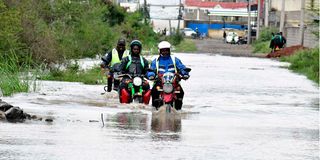
Motorists drive through a flooded section of Kenyatta Avenue in Nairobi on March 20, 2026, following heavy rainfall.
Photo credit: Bonface Bogita | Nation Media Group
In Nairobi, major roads expected to experience flooding include Uhuru Highway, Jogoo Road, Kangundo Road and Thika Road, as well as some roads in Westlands. The central business district is also being monitored because of previous flooding.
Nairobi County Chief Officer for Disaster Management Bramwel Simiyu said the county was clearing drains and waterways to prevent stormwater blockages.
“Our focus is on mitigation and preparation at this point, but also preparing our response perspective to be ready, and in the worst-case scenario to help those who will be affected,” he said.
The county estimates that 22,000 to 25,000 households could be affected under a medium-case scenario, rising to 100,000 in the worst case.
Schools have been identified as possible holding centres, while rescue teams, boats, emergency lines and relief supplies are being prepared.
The lower Tana basin is among the most vulnerable areas. The river runs from Mount Kenya to the Indian Ocean, with flooding risks particularly around Garissa, Madogo, Bura, Hola and the delta.
Madogo was cut off during the 2023/24 El Niño rains, while the flat terrain of the Tana delta makes it particularly susceptible to flooding.
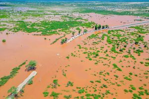
A submerged road and structures in Lake Bogoria, Baringo South on September 10, 2026.
Photo credit: Boniface Mwangi | Nation Media Group
Western Kenya also faces risks along the Nzoia, Nyando and Yala rivers. In the lower Nzoia, parts of Budalangi and Bunyala remain vulnerable despite measures such as raised dykes.
In the Rift Valley, Narok town has been identified as a potential hotspot.
Further north, rising water levels in Lakes Bogoria and Baringo have raised concern over the shrinking distance between the two water bodies.
The Ewaso Ng’iro River is another concern, particularly around Isiolo, where flash floods could cut roads before the river drains into the Lorian Swamp.
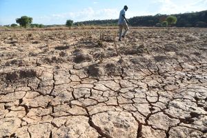
Eastern and northern Kenya face a different danger. Wide, normally dry riverbeds and lagas can turn into fast-moving channels when heavy rain falls on dry ground.
Kitui and parts of Tana River are vulnerable, while Turkana, Wajir, Mandera, Marsabit and Garissa could experience flash floods with little warning.
Kilifi is also at risk because of the Athi and Sabaki rivers, while parts of Taita Taveta, Kwale, Elgeyo Marakwet and West Pokot face risks linked to their terrain.
KMSA is using 2015 as an analogue year for the current forecast because of similarities in the evolution and expected behaviour of El Niño and the Indian Ocean Dipole.
The service says the current rains may not reach the devastation recorded during the 1997/98 El Niño episode, but it is continuing to monitor warming in the Pacific Ocean.
The warnings come as the Government seeks to avoid a repeat of the 2023/24 floods, which caught authorities off guard and killed more than 240 people while displacing more than 790,000.
Government spending on floods between 2017 and 2023 is estimated at Sh23.87 billion, while the economic damage during that period was about Sh187 billion.
The 1997/98 rains caused about Sh155 billion in damage to infrastructure and crops. About 2.3 million animals died from disease, hunger and drowning, while 1.5 million people were affected, 77,000 displaced and about 2,000 killed.
The health sector has also activated contingency measures. Health Principal Secretary Mary Muthoni said plans had been rolled out to help national and county governments, emergency agencies, humanitarian organisations and development partners prepare for flood-related health emergencies.
Particular attention is being given to water- and food-borne diseases such as typhoid, cholera, dysentery, hepatitis A and other diarrhoeal illnesses, which can rise when floods contaminate water supplies and sanitation systems.
The Government has urged Kenyans to follow evacuation and safety instructions, avoid walking or driving through floodwater and rely on information from the Ministry of Health, county governments and authorised emergency agencies.