Africa has just won an important cartographic argument. Now it needs to confront a much harder one about its borders.
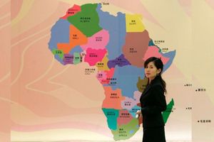
On Friday September 4, the United Nations General Assembly voted overwhelmingly to encourage the world to stop using maps that make Africa appear far smaller than it is. Introduced by Togo on behalf of the African Group, the “Correct the Map” resolution urges governments, schools, international organisations and technology companies to use equal-area projections, such as Equal Earth, when relative size matters.
The resolution does not change geography. It challenges the political imagination produced by geography’s representation. For generations, the Mercator projection has visually diminished Africa while enlarging territories farther from the Equator. Correcting that distortion is therefore more than cartographic housekeeping. It is an act of cognitive decolonisation.
While Africa demands that the world enlarge its external cartographic imagination of the continent, African states continue to shrink its internal political, social and economic space through the way they govern borders.
Africa wants a bigger map, but still thinks too small about what its borders are for.
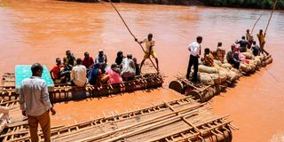
The contradiction is visible everywhere. The African passport, launched with considerable fanfare in 2016, remains inaccessible to most Africans. Crossing the continent still means navigating visas, fees, incompatible procedures and sometimes hostile checkpoints.
The African Union's Free Movement Protocol, adopted in 2018, remains far from entering into force. The Niamey Convention, designed to provide a continental legal framework for cross-border cooperation, similarly languishes. The African Union Border Programme, originally conceived to promote peace, cooperation and integration across borders, remains chronically dependent on external financing.
These failures have something in common. They reveal not merely an implementation deficit but an imagination deficit.
The problem is not that Africa has borders. Nor is the solution to abolish them. States require territorial jurisdictions. Governments have legitimate responsibilities for security, customs, public health, migration and the administration of law.
For too long, the dominant answer has been defensive. Borders mark where sovereign authority stops. They separate insiders from outsiders. Movement across them is something to regulate, inspect and, increasingly, securitise.
Yet borders can perform another function altogether. They can connect markets rather than merely separate jurisdictions. They can facilitate mobility while managing legitimate security risks. They can enable communities divided by international boundaries to cooperate. They can become sites of shared infrastructure, trade, production and development. And they can serve as institutional interfaces through which African integration becomes something citizens actually experience rather than something governments periodically proclaim at continental summits.
This requires moving beyond the old debate over whether Africa should preserve or abolish its inherited borders.
African states can preserve their territorial boundaries while radically repurposing what those boundaries do.
The distinction is crucial. The decision by independent African states to respect inherited territorial limits was intended to reduce interstate conflict and stabilise a continent emerging from colonial rule. It did not require borders to become permanent walls against African mobility, commerce or cooperation. Territorial stability and functional openness are not opposites.
Indeed, the great unfinished task of African integration may be to separate territorial sovereignty from border restrictiveness.
Sovereignty need not mean exercising maximum control over movement simply because a state possesses the legal authority to do so. A confident state can use that same sovereignty to facilitate lawful mobility, create one-stop border posts, recognise compatible identification systems, establish cross-border economic zones, cooperate with neighbouring authorities and allow borderland communities to turn geographical proximity into economic opportunity.
This is repurposed border sovereignty: sovereignty exercised not simply to defend territory, but to enlarge the possibilities available to the people living within and across it.
The African Continental Free Trade Area cannot realise its transformative potential if goods supposedly moving through a continental market repeatedly encounter borders designed primarily as barriers. Free movement cannot coexist indefinitely with a political culture that treats African mobility as inherently suspicious. And cross-border cooperation cannot flourish if it remains a donor-financed experiment rather than a normal function of African governance.
This is why the “Correct the Map” campaign contains a lesson much larger than cartography. A map is not merely a picture of territory. It embodies assumptions about political space. So does a border.
True cartographic decolonisation therefore cannot end with making Africa appear larger on the world’s maps. It must also make Africa function as a larger political, economic and human space.
The measure of a successful African border should no longer be merely whether it protects territorial integrity. We should also ask whether it produces peace, enables legitimate mobility, expands trade, connects borderland communities, facilitates regional integration and generates measurable dividends for the populations living around it.
The border would then cease to be understood primarily as the edge of the state. It would become one of the places through which the state connects its citizens to the rest of Africa.
Africa is, therefore, right to demand a map that represents the continent at its true physical scale. But correcting the projection is only half the decolonisation project.
The larger challenge is to build a continent worthy of that larger map. Africa needs borders with a different purpose.
By Prof Wafula Okumu is the Executive Director of The Borders Institute and a Visiting Professor of Practice at the London School of Economics and Political Science. He writes in his private capacity.