The rapid transformation of Mwihoko and Kamakis — Nairobi Metropolitan's annex along the city's Eastern Bypass — from quiet, green landscapes into dense residential and commercial hubs tells a familiar story of urban growth. Beneath it, however, lies a quieter, irreversible loss.
Where concrete now stands, there once existed an ecosystem that supported wildlife ranging from giraffes and gazelles to hyenas and even occasional hippopotamuses along seasonal waterways. Today, that ecological memory is buried beneath tarmac roads, apartment blocks, and the entertainment joints that define the modern Kamakis strip.
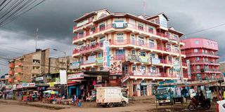
For residents who have lived through the transition, the change is stark. What was once open land, forming part of a broader ecological corridor across Ruiru, has been replaced by an unbroken stretch of urban sprawl that continues to expand outward from Nairobi into neighbouring Kiambu County.
"You would see animals here. Today, it is all buildings and heat," said Melvin Mwangi, a resident of Mwihoko.
Mwihoko shopping centre in Ruiru.
Photo credit: Bonface Bogita | Nation Media Group
Brian Kanyuira, also a resident, echoed the sentiment, saying that two decades ago, gazelles and zebras grazed in the neighbourhood and lived harmoniously alongside locals.
"Seeing a giraffe, a gazelle, or a zebra crossing here or there was just part of life," he said.
Data paints a clearer and more alarming picture of what has been lost. Satellite-based research tracking land use in Kiambu shows a steady decline in vegetation cover between 1995 and 2018, accompanied by a sharp rise in built-up areas.
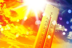
During the same period, land surface temperatures in parts of Kiambu rose dramatically, with recorded highs reaching 42.8°C, up from about 19.5°C in earlier years, a direct reflection of reduced vegetation and expanding urban surfaces.
This is according to a study in the University of Nairobi’s digital repository titled Analysis of the Correlation Between Land Use Land Cover (LULC) Changes and Urban Heat Island (UHI). The study shows that Kiambu lost more than 4,000 hectares of farmland in 23 years.
“Increased impervious surfaces (roads, buildings) strongly correlate with higher Land Surface Temperatures (LST). Satellite remote sensing such as Landsat indicates that reducing vegetation/water bodies raises surface temperatures, driven by urbanisation,” the 2018 study says. Across the wider Nairobi metropolitan area, the trend is equally evident.
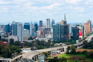
The city lost approximately 22 per cent of its green cover between 1988 and 2016, largely because of construction and infrastructure expansion.
According to Wallbarn, a global supplier of construction products, the loss of vegetation is creating a dangerous heat island over Nairobi.
“Kenya’s capital used to be known as the ‘Green City in the Sun’ for its lush environment. There have, however, recently been major changes to Nairobi’s land cover — what is on the ground’s surface. Most recently, there was uproar over the felling of hundreds of trees to make way for the construction of the Nairobi Expressway,” a study published on Wallbarn’s website reads.
These figures are not just environmental statistics; they are the blueprint of a changing climate. As vegetation disappears, surfaces such as concrete and asphalt absorb and retain heat, raising local temperatures. Nairobi’s average temperature has already increased from about 18.8°C in the 1950s to 19.5°C in the 2000s, with urban expansion accelerating the trend.
Recent studies confirm that vegetation loss and land conversion are directly linked to rising temperatures and declining thermal comfort in urban spaces.
For residents, this is no longer theoretical; they are already experiencing the change. “Even at night, one feels the heat inside the house,” said Peter Njoroge, a boda boda rider.
Beyond heat, flooding is another emerging consequence.
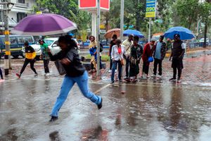
Natural landscapes once absorbed rainfall, allowing water to seep into the ground. Today, paved surfaces dominate, forcing water to flow rapidly across roads and into homes. Studies show that vegetation loss reduces soil absorption capacity, increasing runoff and flood risk in urban areas.
In Kamakis and Mwihoko, this has translated into flooded streets, overwhelmed drainage systems, and growing vulnerability during heavy rains.
“As we speak, flooding is a major challenge. Initially, rain would just disappear into the ground, but currently that is not the case,” said Abraham Kariuki, a resident who has lived in Mwihoko for more than 25 years.
Amid the widespread clearing of vegetation, one notable contrast remains: Northlands City, a large-scale development linked to the Kenyatta family.
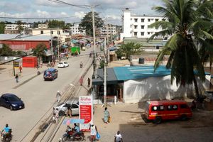
Businesses along the Eastern Bypass in Kamakis.
Photo credit: Bonface Bogita | Nation Media Group
There, tree cover and planned green spaces have been preserved, highlighting what controlled, environmentally conscious development can achieve.
Urbanisation in Kiambu County, where Kamakis lies within the annexed metropolitan area, has accelerated rapidly, driven by population growth and Nairobi’s expanding footprint. But experts say development has outpaced planning. There is a strong inverse relationship between vegetation and built-up areas, meaning that as construction rises, greenery declines almost proportionally.
This imbalance has created what planners describe as “climate-vulnerable urban zones”, areas where heat, flooding, and environmental stress converge. For many residents, the transformation is both a blessing and a burden.
Kamakis has become a thriving commercial hub. Jobs have been created, land values have surged, and infrastructure has improved. What was once peripheral is now prime real estate. But these gains come with hidden costs: rising temperatures, deteriorating air quality, and the loss of natural buffers against climate extremes.
This is the paradox at the heart of the story: development has improved livelihoods, but it has also eroded the environment that once sustained them.
What is unfolding in Kamakis and Mwihoko is not an isolated case; it is a preview of what many peri-urban areas across Kenya could become. Urban growth is inevitable. But without integrating green infrastructure, enforcing zoning laws, and protecting ecological corridors, that growth risks becoming unsustainable.
The forests that once hosted wildlife in these areas are unlikely to return. The giraffes, hyenas, and gazelles have long since disappeared. What remains is a new landscape, one defined not by nature, but by human ambition.
As Kenya pushes forward with urban expansion, the lesson from Kamakis and Mwihoko is clear: climate change is no longer a distant threat. It is already being built, one estate, one road, one cleared forest at a time.