Thousands of kilometres away, beneath the tropical Pacific, a vast expanse of the ocean is warming.
And this warming is part of a climate phenomenon that has the power to reshape weather patterns far beyond, including the rains that millions of Kenyans depend on.
It's El Niño. The phenomenon doesn't arrive every year, but when it does, its effects are difficult to forget. It happened in 2023-2024. It also happened in 2015, 1997, and some people can even recall the impacts of an El Niño event in 1985.
This year, the warming waters of the Pacific are sending increasingly strong signals. Across the major climate centres, forecasts are converging on a strengthening El Niño, with a high likelihood that it will reach very strong levels later this year.
In June, the World Meteorological Organisation (WMO) said El Niño conditions were developing, putting the likelihood of an El Niño event between June and August at 80 per cent, with the probability rising to around 90 per cent through September to December. Most models at the time pointed to at least a moderate event, with the possibility of it becoming strong.
By August, the signal had strengthened. The WMO said El Niño was intensifying steadily, while the US Climate Prediction Centre raised its assessment of the likelihood of a very strong event later in the year.
Now, the latest regional outlook from the IGAD Climate Prediction and Applications Centre (ICPAC) forecasts above-normal rainfall across much of the Greater Horn of Africa (GHA) during the October-December season, with the strongest signals for wetter conditions over Northeastern Kenya, Southern Ethiopia, and Central and Southern Somalia.
The GHA region comprises Burundi, Djibouti, Eritrea, Ethiopia, Kenya, Rwanda, Somalia, South Sudan, Sudan, Tanzania, and Uganda.
ICPAC says there is an 81 per cent probability of a very strong El Niño later this year. The conditions are expected to persist into March- May 2027, the long rainy season, with a 97 per cent probability.
For Kenya, the regional forecast indicates an increased likelihood of above-normal rainfall across much of the country.
The forecast was released following the 74th Greater Horn of Africa Climate Outlook Forum (GHACOF) that concluded in Kigali, Rwanda, yesterday.
In parts of Central Kenya, the Lake Victoria Basin, Burundi, Western Rwanda, Central and Southern Somalia, and Western Tanzania, the ICPAC models give more than a 90 per cent probability of rainfall exceeding 400 millimetres.
To give a more precise picture, Kenya Met says the regional outlook will be downscaled in the coming days. Already, the government has classified 18 counties that are most vulnerable to the impacts of above-normal rainfall. It also flagged Nairobi, Kisumu and Mombasa cities among the top high-risk urban hotspots.
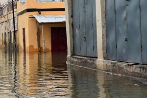
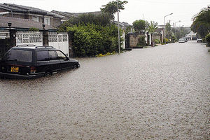
A flooded residential area in Nairobi after heavy rainfall in the past. In 1997/98, El Nino rains in Kenya caused heavy flooding and landslides that displaced thousands. Several international agencies have pledged to support the El Niño mitigation plans. FILE PHOTO | NATION MEDIA GROUP
Temperatures to remain above average
The climate centre observes that the Eastern part of the whole region has some of the highest probabilities of above-average temperatures.
“ Both above-normal rainfall and temperature can occur because they have a single driver. The warm sea surface temperature in the Pacific (El Niño) is associated with a general increase in temperatures as it dumps a lot of heat to the atmosphere. The expected warming of the Indian Ocean is also expected to contribute to atmospheric heating,” offers Eunice Koech, Climate Modelling Expert, ICPAC. “The combination, however, does not mean that the region will not have cooler than normal periods within the season.”
The regional forecast indicates a higher chance of early to normal onset of the OND rains across parts of Africa, including Central and Eastern Kenya and most parts of Tanzania. The Western parts of the region, meanwhile, could experience delayed onset.
ICPAC attributes the differences partly to the influence of Elnino, which can reduce September rainfall before its effects transition towards wetter-than-usual conditions later in the season.
But, above normal rainfall does not mean heavy rains, every day. Ms Koech explains that this is the expected cumulative rainfall by the end of the season. “ Within the season, we will still experience dry spells. Dry spells of up to 10 consecutive days are expected over Southern parts of Ethiopia, Somalia, North-Eastern Uganda and Southern Sudan. Northern Kenya is likely to experience dry spells of up to eight days,” she offers.
Climate experts have also compared the current ocean temperatures and the evolution of the El nino index with previous years and identified 1997 and 2023 as analogue years. This means, past years whose climate patterns looked similar to what scientists are seeing now.
Both years experienced El Niño conditions during the OND season and recorded wetter-than-normal conditions across much of the region.
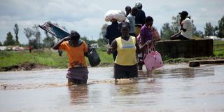
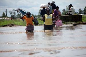
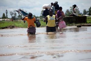
Residents of Ombeyi Village in Ahero move to safer grounds after their houses were flooded by El Nino rains on November 17, 2015.
Photo credit: File | Nation Media Group
The climate centre, however, cautions that the two years should not be treated as substitutes for the 2026 forecast.
“The impacts are always different for each year even when they have common drivers like El Niño. Compared to 1997, many countries are now more prepared and are already prepositioning finances and plans to act early. Lessons from previous years have played a key role in the preparations that countries are undertaking,” offers the climate modelling expert.
Previous episodes of heavy rainfall have come at a steep cost, claiming lives, damaging homes and infrastructure, damaging crops, disrupting essential services and running into billions of shillings in losses.
Now, calls for early preparedness are growing among the public, civil society organisations and humanitarian actors.
“East Africa must stop treating every drought or flood as an isolated emergency. The region needs to move from repeatedly responding to disasters to systematically building resilience through long-term investments in preparedness, risk reduction and climate adaptation. This means strengthening the systems, infrastructure, institutions and land-use practices that reduce vulnerability before climate shocks occur.
At the farm and landscape level, this requires scaling up approaches that help communities manage water, protect soils, restore degraded
ecosystems and sustain productivity despite increasing climate variability,” says Vi Agroforestry.