County governments have stepped up preparations for the anticipated above-average rainfall during the October-December season, with some setting aside millions of shillings for emergencies, mapping high-risk areas and identifying evacuation centres.
But a Nation spot check shows that preparedness remains uneven, particularly in areas prone to flooding and landslides, with some administrators racing against time to address longstanding infrastructure gaps.
In Nyando, residents of flood-prone Konim village have formed a disaster and risk management group to prepare for the rains.
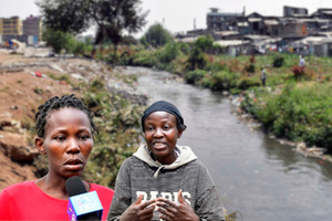
The group plans to clear blocked trenches, culverts and drainage channels, desilt waterways and construct dykes to prevent River Nyando from flooding the village. About 1,500 people live in the area, where recurrent floods destroy homes, disrupt livelihoods and force families to seek temporary shelter. “The stagnant water always comes with waterborne diseases. Houses have also been destroyed in the past,” said Mr Josephat Obul., a resident.
A multi-agency team assessing flood hotspots has identified an exit route through which River Nyando water flows into surrounding communities. National Water Harvesting and Storage Authority chief executive Julius Mugun said engineers planned to close it, potentially addressing up to 80 per cent of the flooding problem in Nyando.
The authority also plans to inspect dykes, protect eroded riverbanks and desilt the river channel beneath Nyando Bridge. A long-term proposal, the Soin-Koru Dam, remains dependent on funding.
Construction workers build stormwater drains along Mombasa Road in Nairobi on August 1, 2026, amid efforts to improve drainage and reduce flood risks ahead of the anticipated October–December rains.
Photo credit: Wilfred Nyangaresi | Nation
Nyando Deputy County Commissioner Elijah Maranga said about 10 evacuation centres were ready, with food, non-food items, medical supplies, mosquito nets and drugs for waterborne diseases prepared.
In Trans Nzoia, preparedness is described as a mix of action and gaps. A Nation spot check found no ongoing work to repair dilapidated drainage systems in Kitale.
Residents of Namanjalala have also protested years of flooding, saying more than 700 acres of farmland along a river are affected.
Officials, however, say emergency committees have been activated. Kenya Red Cross coordinator Ruth Miningwo said flood and landslide hotspots had been mapped in all five sub-counties, including areas along River Sabwani and the Amani and Kaptega dams.
Volunteers are being trained in first aid and divers are being prepared for search-and-rescue operations.
Residents of Ombeyi Village in Ahero move to safer grounds after their houses were flooded by El Nino rains on November 17, 2015.
Photo credit: File | Nation Media Group
In Turkana, authorities are preparing for increased water flows from neighbouring counties and countries. Meteorological officials say some areas could receive rain as early as September. Schools in Turkana East have been flagged for preparedness, with parents to be mobilised around evacuation plans and safe areas. The county also plans to drill five boreholes in Kanamkemer and Township wards to safeguard water supplies if floods damage infrastructure.
Residents, however, remain concerned about drainage. In California, Lodwar, Ekaran said roads had been improved but drainage was failing to channel floodwater into the seasonal River Kawalase, leaving stagnant water around homes.
The county is also seeking to establish a command and coordination centre for real-time information sharing. In Uasin Gishu, heavy machinery has been deployed in flood-prone parts of Kapseret, Kesses and Turbo to unblock waterways, open drainage paths and desilt culverts. Evacuation protocols and safety centres are also being established.
Nyeri has allocated Sh20 million for emergency response. Schools in landslide-prone Mukurweini and Tetu will serve as evacuation centres, while drainage systems in flood-prone Mathira and Kieni are being improved. The county will use the Nyumba Kumi network for early warnings and has provided toll-free number 1549 for emergencies. Each sub-county has an ambulance, while St John Ambulance and Kenya Red Cross will support response.
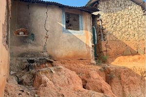
In Embu, authorities have established a disaster preparedness committee. Murang’a, despite being classified as highly vulnerable to landslides and mudslides, still has major gaps. In Maragua, an open sewer remains blocked, while feeder roads without drainage in Kahumbu expose homes to stormwater. The county has allocated Sh27.7 million for disaster management and social welfare in its Sh12.5 billion 2026/27 budget. Youth Service teams are clearing drainage channels in major towns. In Meru, quarries in Imenti South and Imenti Central and areas near the Nyambene Ranges have been identified as landslide hotspots. Maua is also considered flood-prone. The county has allocated Sh29 million for emergencies in 2026/27, although no money has been allocated for emergency relief in the current financial year.
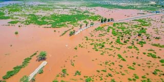
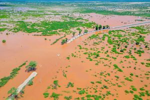
A Kenya Red Cross official assists journalists to cross a flooded section of the Lamu-Garsen-Witu road in this photo taken on December 3, 2023.
Photo credit: Kevin Mutai| NMG
Bomet has mapped flood hotspots in Chepalungu, Sotik and lower parts of Bomet East and is sensitising residents to move away from riverbanks and flood-prone areas. Officials are also preparing for possible malaria and waterborne disease outbreaks.
In Kericho, Kipkelion East and Kipkelion West have been identified as mudslide-prone. Municipal boards are clearing stormwater drains, while residents are being advised to move to higher ground.
In Narok, flood-prone Narok South and Narok West have benefited from stormwater drainage and raised footpaths. Nakuru officials have warned that rising water levels in Lakes Nakuru and Naivasha could threaten nearby settlements, while heavy rain could cause erosion and loss of farmland. Flooding could also contaminate water sources and increase waterborne diseases. A toll-free line has been established for reporting emergencies.
In Kwale, vulnerable areas include Kiwegu, Perani, Jasini and Majoreni in Lungalunga, Diani and Ukunda in Msambweni, and parts of Matuga and Kinango.
Authorities are working with village elders to strengthen early warnings and have identified social halls, churches and mosques as evacuation centres in Vanga, Diani-Ukunda and Shimoni.
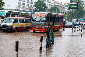
In Mombasa, a multi-agency team involving the Kenya Navy, police and county government is preparing ambulances, fire engines and rescue centres. However, a spot check found that drain-clearing had yet to begin. The county plans to hire youths for the work and has allocated Sh20 million to its Emergency Fund Services for 2026/27.
Tana River and partners, including the Kenya Red Cross, Concern Worldwide and Welthungerhilfe, have developed sector-specific advisories on preparedness, safety and early action. They will be disseminated through radio, public barazas, community structures and digital platforms.
Kilifi has developed an El Niño Contingency Plan covering interventions before, during and after the rains, with the Kenya Red Cross and other organisations supporting response and recovery.
Lamu has set aside at least Sh40 million for emergencies and identified evacuation centres. Vulnerable areas include parts of Witu, Mkunumbi, Hongwe, Hindi, Kiunga and Basuba. Early warnings are being relayed through local radio stations, while voluntary evacuation of residents in flood-prone areas is due to begin next week.
Reporting by Domnic Ombok, Evans Jaola, Sammy Lutta, Titus Ominde, Mercy Mwende, George Munene, David Muchui, Martin Mwaura, Mwangi Muiruri, Winnie Atieno, Kalume Kazungu, Mercy Koskei and Vitalis Kimutai.